Note — This is part 2 of 3 in a series. See part 1 here and part 3 here.
Day 3: Wednesday April 6
Start/End: Upper Waiau Forks/West Sabine
Distance: 14.5km
Elevation Gain: 1000m
Time: 9 hours
Trail type: Rock scramble, steep vegetation and solid rock climb, scree climb/descent
Conditions: Clear sky and sun with minimal cloud, trail/route fairly well-marked but significant wet/slick rock
Difficulty: Hard, dangerous if snow/ice
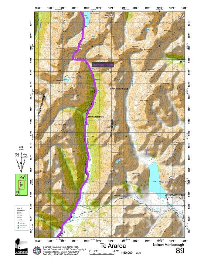
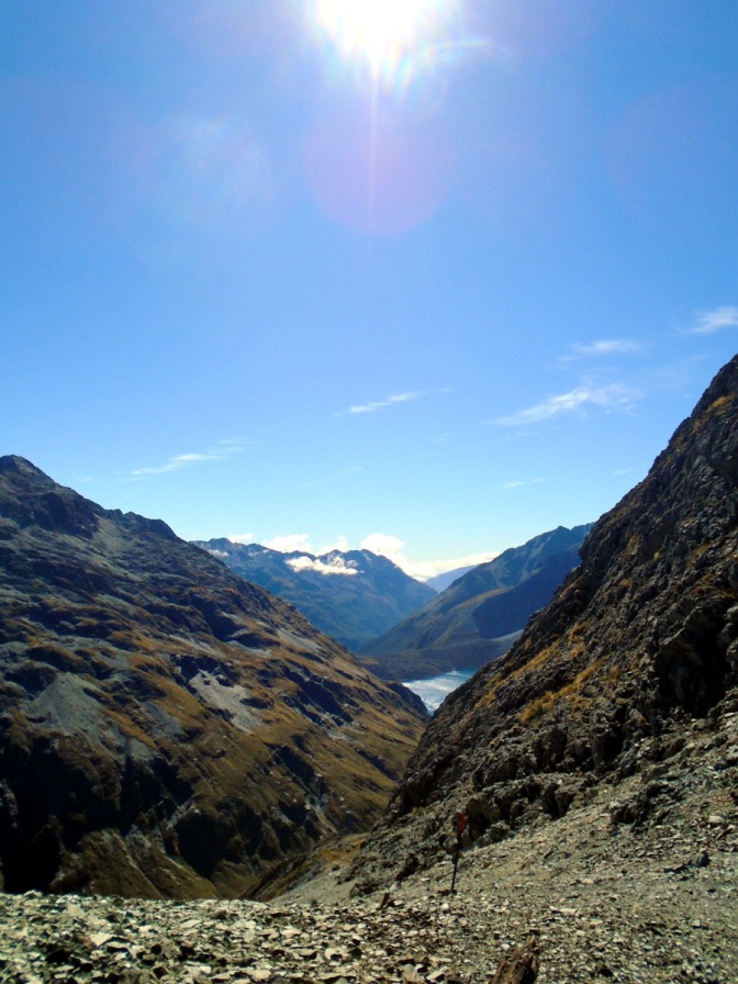
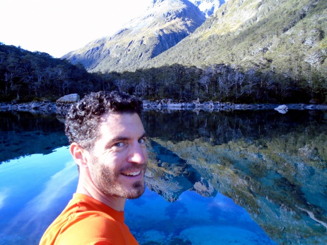
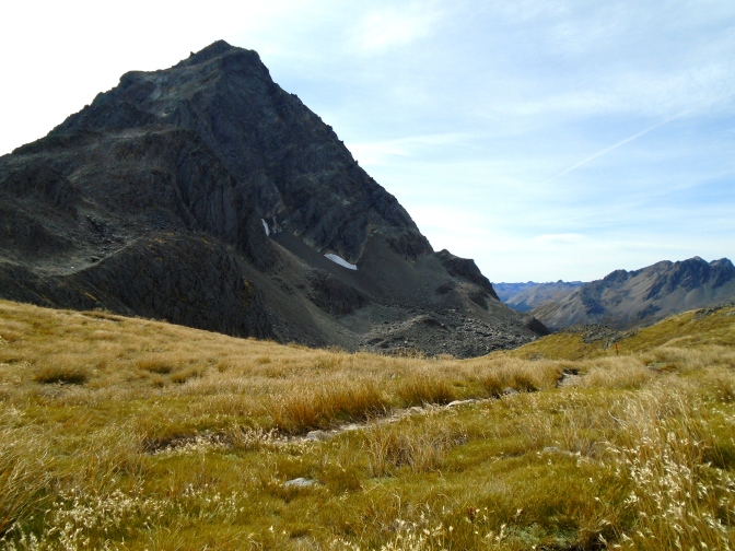
Today’s hike was the biggest question mark of my planned route. The Waiau Pass Track is one of the most dangerous parts of the Te Araroa trail and includes traversal of Waiau Pass at 1870m which is “a fair weather route, suitable for experienced individuals.” My original plan was to do this 6 day hike a different week, but I moved it to this week specifically because the weather forecast looked good for crossing Waiau Pass without snow or rain. Given my level of fitness and planning and the good weather the climb to the top was strenuous but not dangerous. Many places required finding a route between snow poles — choosing which large, slick rock faces to get my hand and foot holds and testing the strength of vegetation for holds and ledges. In my opinion this was easier going up than it would have been going down because of the risk of sliding on wet surfaces when stepping down half a meter to a meter at a time on holds that were sometimes a few centimeters wide.
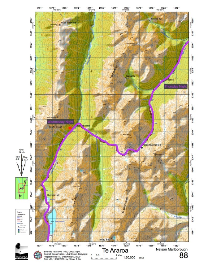
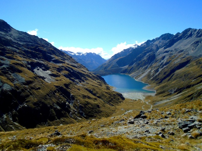
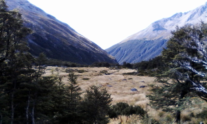
The last 100-150 meters was a gently graded scree climb to a beautiful spot marking the border between the St James Conservation Area and Nelson Lakes National Park. The St James side had a lower bush line and more rocky / brown tussock / wind swept look to it and the Nelson Lakes side had a more lush forested / green and blue / watery look to it. The best views of my 6 day trip were from Waiau Pass through the Lake Constance bluffs down to the Blue Lake. I had many other great views on the trip, but this was one of the most unique I have seen in New Zealand and well worth the strenuous morning climb.
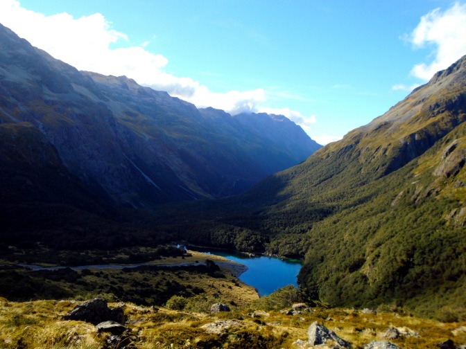
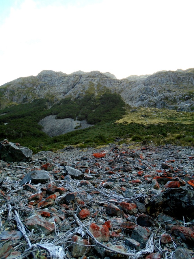
The Lake Constance bluff track itself could use a re-route so that it doesn’t climb directly with the waterfall. Either that or some better cut dirt stepping as it was quite a steep climb up overgrown and wet vegetation from the lake to the bluff. There were a few points where no footholds were really available and I was pulling myself up with a combination of hand holds and body/knee holds using a hiking pole. Again, I think this was easier climbing up than going down (unless you were willing to jump/slide 10-20m down with potential of falling off the bluff into the rocks/lake). The Blue Lake track towards West Sabine hut was not difficult but very rocky with 5-6 avalanche morraines to cross so my knees/ankles/feet were not happy at the end of that.
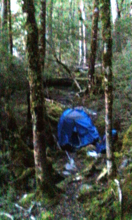
This day was the highlight of the trip and in some ways the reason for the trip altogether. It was a tremendous combination of ridiculously great views reached by an invigoratingly challenging series of intensive route finding, strenuous scrambling/climbing, and some steep downhill scree sliding/descent. I did manage to waste just enough time during breaks in the day to fall short of the West Sabine hut and had to camp in the middle of the track as the valley got too dark to navigate safely around 6PM (I had set out at 8AM). It turned out the next morning that I was only 5-10 minutes short of the hut, but I don’t regret making the call to camp again even though it was around 0-2C overnight.
Day 4: Thursday April 7
Start/End: West Sabine/John Tait Hut
Distance: 13.5km
Elevation Gain: 1200m
Time: 8 hours
Trail type: Rooty forrest walk/climb, wet stream beds, steep scree/morraine climb, steep boulder descent
Conditions: Clear sky and sun with minimal cloud, trail well-marked and dry rock
Difficulty: Moderate+
After waking up and doing a fast pack of my tent I was on the trail by 7:15. I walked another 5 minutes and came to the bridge over the Sabine river which took me directly to the hut. I stopped and talked to several of the hikers there to get an updated weather forecast and took 15 minutes to sit by the river and deliberate what I was going to do next. My original route would be two 8-10 hour days with a high amount of elevation gain. The alternative option would be two 3-5 hour days with not even half the total elevation gain but would skip Travers Saddle. The weather forecast was for descent weather Thursday but rain/wind on Friday. My feet/legs were somewhat tired and blistered at this point and I was questioning my resolve to do 6 full on days. Maybe I should take it easier for two days…
In my mind I was beginning to make an arbitrary choice between the Travers Saddle and Angelus. Ultimately my sense of adventure won out — I would stick to my original route, enjoy the hell out of the steep climb to Travers and the good views and if my body and/or the weather didn’t hold up for a second climb to Angelus then so be it. Better to go after something today that you think you can do than worry about whether you might not have the strength left for tomorrow.
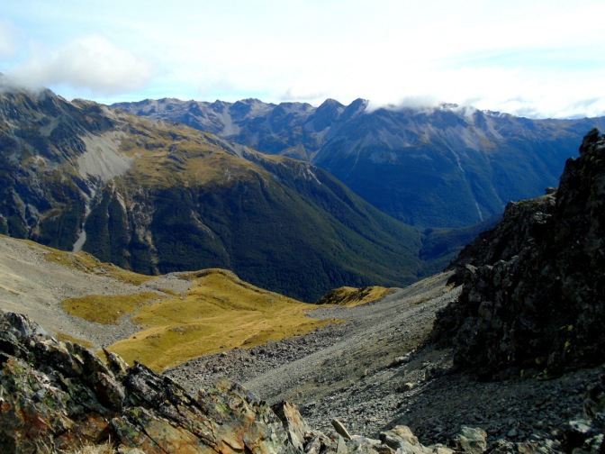
The rest of the morning was a steady climb up side streams and rooty forrest walk until I got to the bottom of an avalanche section. This was a rather steep section that most hikers descend, but I was doing the trail the reverse direction of the usual. As I grinded my way up the steep scree and rock for about 300 meters over the next hour I received several condolences from descending hikers and enjoyed the respite of talking with an older hut warden from Tasmania when I was close to the top. From the top of the avalanche section it was about another hour of superb views and moderate elevation gain over boulders and trail to the Travers Saddle.
After a bit of exploring and picture taking at the saddle I began a rapid descent and fast hiked/ran/bounded down past the Upper Travers hut to make my destination of the John Tait Hut in around 4 hours. This was the final key to my route because each day I had planned a fall back option where I could cut the day short by around 3 hours but by doing so would likely not make Angelus on my final day. Upon reaching the John Tait hut I knew that my body would be able to make the full epic trip — provided the weather would not rain too heavily on Friday.

Did the descent bother your toes/shoes/legs? Steep?
LikeLike
Very steep, and yes, there were some blisters and soreness but nothing too bad!
LikeLike